![](/images/other/stat-length.png)
![Trail Walking Le Havre - Le Havre de la plage aux jardins suspendus - Photo](https://media.geolcdn.com/t/1900/400/3ab9b6bb-ea38-47b7-8889-9537493f2269.jpg&format=pjpeg&maxdim=2)
Le Havre de la plage aux jardins suspendus
zazie
User
![Length](/images/other/stat-length.png)
Length
22 km
![Max alt](https://static1.geolcdn.com/siteimages/upload/files/1508320355ic_sort_altitude_max_24dp.png)
Max alt
98 m
![Uphill gradient](https://static1.geolcdn.com/siteimages/upload/files/1508320355ic_sort_den_pos_24dp.png)
Uphill gradient
333 m
![Km-Effort](/images/other/stat-length.png)
Km-Effort
27 km
![Min alt](https://static1.geolcdn.com/siteimages/upload/files/1508320355ic_sort_altitude_min_24dp.png)
Min alt
-2 m
![Downhill gradient](https://static1.geolcdn.com/siteimages/upload/files/1508320355ic_sort_den_neg_24dp.png)
Downhill gradient
333 m
![Boucle](https://static1.geolcdn.com/siteimages/upload/files/16400158638029165_repeat_loop_refresh_sync_direction_icon.png)
Boucle
Yes
Creation date :
2019-09-25 13:27:30.712
Updated on :
2019-09-25 16:52:15.849
![Walking](https://static1.geolcdn.com/sitytour/trail-icons/101.png)
5h00
Difficulty : Medium
![Running](https://static1.geolcdn.com/sitytour/trail-icons/103.png)
3h00
Difficulty : Medium
![Scan this QR Code to open this trail in the SityTrail application](https://capi.geolives.com/qq0zvz2zws4bq2lad0pu/sitytour/trails/2213935/qr.png?size=200)
FREE GPS app for hiking
About
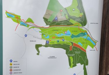
Trail Walking of 22 km to be discovered at Normandy, Seine-Maritime, Le Havre. This trail is proposed by zazie.
Description
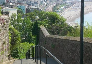
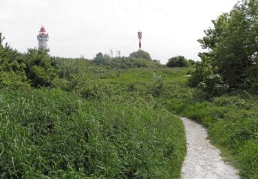
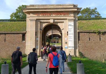
Promenade à travers quelques éléments clés de la ville du Havre en passant par les ports, la plage, les anciennes fortifications de l'estuaire, les jardins suspendus, de nombreuses marches pour de belles petites ruelles. Prévoir casse croûte et boissons.
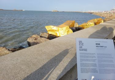
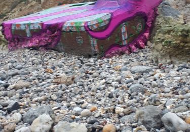
Positioning
Country:
France
Region :
Normandy
Department/Province :
Seine-Maritime
Municipality :
Le Havre
Location:
Unknown
Start:(Dec)
Start:(UTM)
291836 ; 5486272 (31U) N.
Comments
Trails nearby
![Trail Walking Le Havre - Découvrir Le Havre - Photo](https://media.geolcdn.com/t/375/260/ext.jpg?maxdim=2&url=https%3A%2F%2Fservices.sitytrail.com%2FGeolivesWS%2FDownloadMedia.ashx%3FTrailID%3D173067%26Media%3D14597_6.jpg)
![Walking Walking](https://static1.geolcdn.com/sitytour/trail-icons/101.png)
Découvrir Le Havre
Walking
Difficult
(1)
Le Havre,
Normandy,
Seine-Maritime,
France
![](/images/other/stat-length.png)
14.2 km | 17 km-effort
3h 30min
![](https://static1.geolcdn.com/siteimages/upload/files/16400158638029165_repeat_loop_refresh_sync_direction_icon.png)
Yes
![Trail On foot Fontaine-la-Mallet - Les Bassins des Vallées - Photo](https://media.geolcdn.com/t/375/260/ce57ffe6-f4ea-486c-bc79-47861158f9a7.jpeg&format=jpg&maxdim=2)
![On foot On foot](https://static1.geolcdn.com/sitytour/trail-icons/100.png)
Les Bassins des Vallées
On foot
Easy
Fontaine-la-Mallet,
Normandy,
Seine-Maritime,
France
![](/images/other/stat-length.png)
5.1 km | 6 km-effort
1h 21min
![](https://static1.geolcdn.com/siteimages/upload/files/16400158638029165_repeat_loop_refresh_sync_direction_icon.png)
No
![Trail On foot Le Havre - Autour du Cap - Photo](https://media.geolcdn.com/t/375/260/5d7ac9de-0a46-49c7-8cfc-4f8d63e71135.jpeg&format=jpg&maxdim=2)
![On foot On foot](https://static1.geolcdn.com/sitytour/trail-icons/100.png)
Autour du Cap
On foot
Easy
Le Havre,
Normandy,
Seine-Maritime,
France
![](/images/other/stat-length.png)
4.8 km | 5.9 km-effort
1h 20min
![](https://static1.geolcdn.com/siteimages/upload/files/16400158638029165_repeat_loop_refresh_sync_direction_icon.png)
No
![Trail Walking Le Havre - 076-05-Le Havre A-Midi 9km - Photo](https://media.geolcdn.com/t/375/260/d02b20a6-0462-4a95-b9ff-2029e3ab179d.jpg&format=jpg&maxdim=2)
![Walking Walking](https://static1.geolcdn.com/sitytour/trail-icons/101.png)
076-05-Le Havre A-Midi 9km
Walking
Easy
(1)
Le Havre,
Normandy,
Seine-Maritime,
France
![](/images/other/stat-length.png)
8.8 km | 11.5 km-effort
2h 49min
![](https://static1.geolcdn.com/siteimages/upload/files/16400158638029165_repeat_loop_refresh_sync_direction_icon.png)
Yes
![Trail On foot Le Havre - Parc de Rouelles - GR - 16-09-2024 - Photo](https://media.geolcdn.com/t/375/260/ext.jpg?maxdim=2&url=https%3A%2F%2Fstatic1.geolcdn.com%2Fsiteimages%2Fupload%2Ffiles%2F1545311037marcheuse_200dpi.jpg)
![On foot On foot](https://static1.geolcdn.com/sitytour/trail-icons/100.png)
Parc de Rouelles - GR - 16-09-2024
On foot
Easy
(1)
Le Havre,
Normandy,
Seine-Maritime,
France
![](/images/other/stat-length.png)
9.4 km | 11.6 km-effort
2h 37min
![](https://static1.geolcdn.com/siteimages/upload/files/16400158638029165_repeat_loop_refresh_sync_direction_icon.png)
Yes
![Trail Walking Le Havre - le havre parcs - Photo](https://media.geolcdn.com/t/375/260/96da9185-4728-4bbd-baaf-9500c4363780.jpg&format=jpg&maxdim=2)
![Walking Walking](https://static1.geolcdn.com/sitytour/trail-icons/101.png)
le havre parcs
Walking
Difficult
Le Havre,
Normandy,
Seine-Maritime,
France
![](/images/other/stat-length.png)
12.1 km | 14.5 km-effort
3h 25min
![](https://static1.geolcdn.com/siteimages/upload/files/16400158638029165_repeat_loop_refresh_sync_direction_icon.png)
Yes
![Trail Walking Le Havre - parc rouelles mini pas - Photo](https://media.geolcdn.com/t/375/260/4828ec3b-0ba5-48a6-a7b6-2d96d2df242a.jpg&format=jpg&maxdim=2)
![Walking Walking](https://static1.geolcdn.com/sitytour/trail-icons/101.png)
parc rouelles mini pas
Walking
Easy
Le Havre,
Normandy,
Seine-Maritime,
France
![](/images/other/stat-length.png)
3.1 km | 3.6 km-effort
49min
![](https://static1.geolcdn.com/siteimages/upload/files/16400158638029165_repeat_loop_refresh_sync_direction_icon.png)
Yes
![Trail Walking Le Havre - Le havre front de mer - Photo](https://media.geolcdn.com/t/375/260/3dca226e-3bee-4d91-903b-81db7c6a4339.jpg&format=jpg&maxdim=2)
![Walking Walking](https://static1.geolcdn.com/sitytour/trail-icons/101.png)
Le havre front de mer
Walking
Medium
Le Havre,
Normandy,
Seine-Maritime,
France
![](/images/other/stat-length.png)
8.2 km | 9.7 km-effort
3h 14min
![](https://static1.geolcdn.com/siteimages/upload/files/16400158638029165_repeat_loop_refresh_sync_direction_icon.png)
Yes
![Trail Nordic walking Sainte-Adresse - Le Havre plage - Photo](https://media.geolcdn.com/t/375/260/74f6e575-20b6-423b-8e0f-ed4b954898f3.jpg&format=jpg&maxdim=2)
![Nordic walking Nordic walking](https://static1.geolcdn.com/sitytour/trail-icons/102.png)
Le Havre plage
Nordic walking
Very easy
Sainte-Adresse,
Normandy,
Seine-Maritime,
France
![](/images/other/stat-length.png)
7.2 km | 7.8 km-effort
2h 0min
![](https://static1.geolcdn.com/siteimages/upload/files/16400158638029165_repeat_loop_refresh_sync_direction_icon.png)
No